Amy Mui: High-Resolution Multispectral Satellite Imagery for Identifying Turtle Habitats
Amy Mui was not always in the geomatics industry. Beginning in wildlife biology, she now is a PhD candidate with the Department of Geography at the University of Toronto. Read our interview with her to learn about how she uses high-resolution multispectral satellite imagery to identify and map threatened turtle species habitat – synchronizing her initial for wildlife, and her new found passion for remote sensing.
GoGeomatics Canada: What led you to a career in remote sensing?
Amy Mui: Well I would have to say that I did not follow a very typical nor straight line path to get to where I am today. Rather than build upon an early decision to pursue geomatics I followed a path firmly rooted in wildlife biology and endangered species conservation. Up until three years ago I would have called myself a Biologist rather than a Remote Sensing Scientist or GIS specialist. These days I am working so closely with each of these fields that I don’t quite know what to call myself!
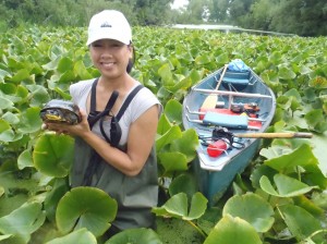 I have a BSc in Wildlife Biology from the University of Guelph and an MSc in Wildlife Health and Management from the University of Sydney in Australia. My previous research examined topics such as the dispersal patterns of juvenile wombats and how extreme temperatures alter the hatching success of freshwater turtles. After graduation I continued in this field with employment at various organizations whose common goal was to contribute to species conservation in some way. After several years of work, travel and volunteering in this field I noticed that despite the many issues facing wild animals today, there was a common thread of habitat loss. And efforts to protect or rebuild lost habitat was limited by political boundaries and differences in resources and policies between different regions. We needed better methods of identifying, monitoring and protecting the environment needed to support healthy populations of any species and we needed to do this on a scale larger than what was possible through on the ground work.
Once I made the decision to return to academia I knew that remote sensing and GIS was the field I wanted to enter. I had read about the ways in which researchers were extracting different types of information from satellite images and I was excited about the possibility of applying this to species conservation. So, I did some research of my own was accepted to the University of Toronto (Mississauga) for a doctoral degree with the Department of Geography.
GoGeomatics Canada: Could you explain to our readers your threatened turtle species habitat work?
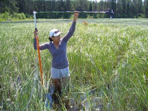 Amy Mui: The focus of my doctoral research is to determine if high resolution multispectral satellite imagery can be used as the basis to identify important turtle habitat across two different seasons. For this work I partnered with the Toronto Zoo in an NSERC funded project which uses the threatened Blanding’s turtle as my focal species. This turtle inhabits freshwater marshes, swamps and ponds which are becoming threatened habitats in southern Ontario where they are becoming increasingly fragmented and degraded.
Using telemetry data from radio-tracked turtles I collected habitat data from locations where turtles were found, in order to identify variables that indicate habitat preference. From here, I have acquired satellite images over two wetland sites during two seasons and I will determine whether these variables can be extracted from the images and input into a model with the purpose of identifying prime turtle habitat across the entire image. It is important to look at two seasons because at our latitude, the turtles’ wetland habitat changes drastically throughout the year and physiological requirements differ from spring to late summer to winter. For example in the early spring, turtles are emerging from hibernation, and travelling widely across shallow and ephemeral wetlands which provide the perfect habitat for finding mates and feeding on invertebrates. In contrast by late summer they will feed less and instead search for deeper pools of water to escape desiccation and the extreme heat. Without looking at these different time scales, all critical habitat may be not be captured.
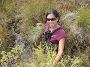
This research is important because seven out of eight species of Ontario turtles are at risk of extinction and the loss of habitat is a major contributing factor. The innovation in this research is the application of remote sensing and GIS methods to model the heterogeneity of small fresh water wetlands for a species that utilizes a small home range compared to other animals such as birds or larger mammals. Reptiles and amphibians in particular have not received as much research attention in this field, however their importance is no less than other more vagile animals, simply because they do not travel as widely.
GoGeomatics Canada: What contributions have you made to the geomatics industry?
Amy Mui: Along with my supervisor, Professor Yuhong He, I have co-authored two papers related to remote sensing of the natural environment. I have also submitted a paper that is currently under review, which discusses the ability of the object-based classification method to accurately identify small and heterogeneous freshwater wetlands in southern Ontario. Wetlands are vital to most turtle species as well as many other reptiles and amphibians but they can also be difficult to identify spectrally due to similar signals across transitional uplands. Using high resolution multispectral satellite imagery I was able to accurately detect wetlands across a variety of landscapes. Next, I hope to extract specific characteristics of these wetlands from remotely sensed data such as vegetation cover and water depth; characteristics that are important to my focal turtle species. If I am successful, then this model can eventually be applied to other turtle species as well.
GoGeomatics Canada: How has your gender played a positive role in your career? Have you had to overcome any gender-based obstacles?
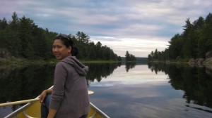 Amy Mui: I am happy to say that thus far my gender has played neither a positive nor a negative role in my career, which is how I believe it should be. Coming into this field with very little experience I had a lot of catching up to do and any evaluations on my performance have been based on my knowledge and skills attained, rather than my gender. However, that is not to say that I am not proud of my accomplishments as a woman. In fact, I have had several very strong female role models which have helped to shape and encourage my career. The chair of my department is a woman and there are also many strong female professors and staff throughout the department and the University. However, the strongest influence has come from my supervisor Yuhong He, who is not only a woman, but a successful professor, researcher and mother. Partway through my degree I made the decision to start a family and rather than having this decision viewed as a negative side effect of taking on a female student, as I am certain has happened to many others before me, my supervisor offered me her full support and guidance. Coming from someone who has achieved a successful career in academia and effectively juggled the demands of both work and home life, her advice has been incredibly valuable and this has had a huge positive impact on me.
Another area where being a female may have been viewed as a detriment is during the field work portion of my research. In order to complete the data collection I have had three field assistants, two of which were very capable females. And after two years of field work not only did we successfully navigate through often inhospitable marshes, swamps and bogs on our own but we also did it carrying very heavy remote sensing equipment. And I think that’s something to be proud of.
GoGeomatics Canada: As a woman in the industry, do you have any tips/suggestions for young women starting out in the industry?
Amy Mui: To any aspiring women keen to take on the challenge of a career in remote sensing, I would suggest that you take confidence in your own abilities as a person and never shy away from any challenge. This is a field where innovative thinking, dedication and patience will lead to success, regardless of your gender. Focus on building your skills in the theory and practice of remote sensing and GIS analysis and to think creatively about how you want to use these skills to solve real world problems.
GoGeomatics Canada: Are you on Twitter or do you follow any map / geomatics related blogs? If so, do you have any industry people you like to follow?
Amy Mui: I am relatively new to twitter, but I joined because I wanted to follow Commander Chris Hadfield aboard the International Space Station. We’re lucky to have such a social media savy astronaut aboard the ISS and I wanted to take full advantage of it! The daily images that he shares from his incredible vantage point fascinates and inspires me at the same time, and reminds me of why I love this field of remote sensing. There is something very humbling about looking down on our planet from so far away, and it gives us a chance to see not only how we have altered our planet, but how we have the power to do better if we work together.



Good luck with your research, Amy!
Keep up the good work Amy!