
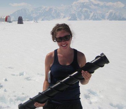
Amy Barker has been working for the Government of the Northwest Territories for over 2 years as a G.I.S. Officer. Amy enjoys working with data pertaining to culture and heritage and is currently working in Ottawa, Ontario. Read Amy’s interview to check out some of her work!
GoGeomatics: Tell us a little bit about yourself. How did your interest in Geomatics start?

Amy:I first developed an interest in Geomatics towards the end of my undergraduate degree…
Trent University: I completed an Honours Science degree in Biology and Anthropology at Trent University and started to learn about G.I.S. in my third year of the program. There was a component on G.I.S. and remote sensing applications in archaeology in one of the courses I was taking. It was in this course that I really saw the value of G.I.S. in archaeological modeling and survey (archaeology has been a passion of mine for quite some time). In the final year of my undergraduate program at Trent, I took a few more focused G.I.S. courses through the geography department. During the summer after graduation, I worked as a G.I.S. Assistant with the Ontario Ministry of Natural Resources in Peterborough, ON as part of the provincial government’s Summer Experience Program.
Fleming College: Seeing the wide-ranging applications of G.I.S. as well as the significance in the field of archaeology/anthropology in particular I knew that I wanted to pursue more focused studies in G.I.S.. I had also heard good things about the Fleming College G.I.S. program from employees at the OMNR. I decided that I would enroll in the G.I.S. – Applications Specialist postgraduate certificate program at Fleming for September of that year. I also knew that G.I.S. and archaeology, although an emerging field, was still quite rare at this point (in terms of employment opportunities) so I thought that the Co-op project as part of the of the certificate program at Fleming would be a great opportunity to carry out some focused work in the field, while potentially networking with individuals in G.I.S. and archaeology.
GoGeomatics: How are you using Geomatics in your current position?
Amy: I am currently completing a long term contract position as a G.I.S. Officer for the Government of the Northwest Territories. I used to work in the office in Yellowknife, NT but am now working remotely out of Ottawa, ON. I use my G.I.S. and cartographic skills in my day-to-day duties; receiving incoming requests for access to heritage data (from our geodatabases), performing geospatial analysis of potential impacts of land developments on archaeological resources, general data management (of our heritage databases – including geodatabases), and significant internal mapping requests pertaining to archaeology and heritage. This position is unique in that the department is housed in the territorial museum (Prince of Wales Northern Heritage Centre), so I also have the opportunity to perform geospatial analysis and mapping for other departments in the museum (i.e. exhibits). I have really enjoyed this position as I have been able to contribute to a variety of different projects, all pertaining to heritage and culture in some way.
GoGeomatics: What skill types have you gained in this field and are they transferable to other types of industries?
Amy: I have gained strong skills in data management – including seeking out sources of data, integrating data, and data maintenance. I also have further developed my problem-solving skills. There is often more than one way to approach a problem/scenario with G.I.S. and I enjoy being able to uncover and carryout one of these approaches. I also truly appreciate how wide-ranging the application of G.I.S. can be across many industries. While I know that employment in G.I.S. & archaeology is still rare, I am comfortable that my G.I.S. skills are transferable to a variety of different industries, such as natural resources, infrastructure/civil operations, all levels of government, private industry, etc. Even outside of the G.I.S. field, I see my data management skills as being transferable to database administration and my cartography skills as being potential transferable to graphic design. I am quite happy with my choice to get into the field of G.I.S. and mapping so far.
GoGeomatics: Do you have any examples of your past or present GIS work that you are willing to share with us (maps, websites, drawings) and can you provide us a brief explanation?
Amy: I have a few samples of maps provide through the Prince of Wales Northern Heritage Centre Museum website:
Here is a map that I created showing archaeological site density in the NWT (using point density analysis in ArcGIS – to produce a raster output layer):

http://pwnhc.learnnet.nt.ca/programs/downloads/medarchsitesdensity.jpg
Here is a sample poster/map that I produced showing the recently designated Territorial Historic Sites in the Northwest Territories:
http://pwnhc.learnnet.nt.ca/programs/historicplaces/index.asp
If you click in each link in the above poster, you are provided with more detailed information on each site as well as a more detailed map – showing the precise feature delineation (also produced by myself):
Ex: Pokiak Territorial Historic Site:
http://pwnhc.learnnet.nt.ca/programs/historicplaces/pokiak.asp
Most of the other maps that I have produced contain sensitive archaeological/heritage data (at larger scales) and therefore have stringent publication rules. I have also produced maps for the majority of the articles in an upcoming supplement in the Journal Arctic (currently in press) – these maps pertain to the study of Alpine Ice Patches throughout circumpolar regions. Furthermore, I have had the chance to contribute as an author on one of these papers.
GoGeomatics: What do you find rewarding/challenging in your GIS career?
Amy: I find the most rewarding aspect of my GIS career is that I am able to contribute my skills to real-world problems and projects. This is particularly true in that the majority of my employment experience as thus far it has been in the public sector. Major decisions may be based on geospatial analysis that I have performed which provides me with a great sense of accomplishment. Furthermore, the results of such analyses may be communicated in maps that I have made, which allows me some artistic expression as well.
The most challenging aspect of my career thus far is ensuring that I keep abreast of new technology and keep my skills current/competitive. This is particularly true as we see the G.I.S. field growing and becoming more accessible. It’s easy to become overwhelmed with the variety of emerging mapping technologies and trying to decide which ones are worth investing training in (i.e. software, programming languages, etc.), especially on a limited training budget. I am currently trying to teach myself more about open-source web mapping software as I see it being a great alternative to some of the more expensive web mapping products out there. It also seems like a great way to provide maps and data to individuals that may not be GIS savvy (i.e. maps that may be “served-up” over the web for co-workers or the general public to explore and query).


Be the first to comment