
-
Why and how does geomatics engineering education need to change?
-
London homeowners now have a tool to see if solar panels fit and mean energy savings
-
Malahat Nation surveying discovers ‘huge amount’ of ghost gear polluting local waters
-
How drones and AI could help stem the spread of a plant invading Quebec parks
-
GHGSat: Commercial satellite will see CO2 super-emitters
-
Canada Launches Mapping Tool for Marine Planning and Protection
-
New LiDAR Point Clouds product: Canada as you’ve never seen it before!
Why and how does geomatics engineering education need to change?
Geomatics has historically seen graduates employed in all sorts of industries ranging from resource management, navigation, and engineering. The University of Calgary is aiming to expand BSc in Geomatics Engineering program by introducing an optional minor programme in software engineering to give students distinct software engineering knowledge and help with associated skills.
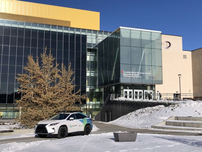
The programs aim is not only to diversify the tools graduates have at their disposal in an internationally expanding industry, but encourage future students to enrol and expand on the industry diverse reach into other data sectors. Read more here
London homeowners now have a tool to see if solar panels fit and mean energy savings
The City of London, Ontario is using an online mapping tool to inform local residents on the potential benefits of equipping their homes with solar panels. The mapping tool, MyHEAT Solar, helps inform residents on the potential overall cost and environmental impact.
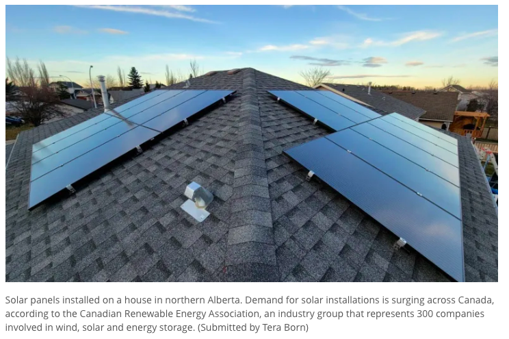
Rooftop solar powers are becoming more and more popular, and similar tools were developed for Edmonton, AB, Fredericton, NB, and Calgary, AB. The specific metrics to individual households will ideally help make homeowners educated decisions on if this is feasible for them. Read more here and check out the London, ON map here.
Malahat Nation surveying discovers ‘huge amount’ of ghost gear polluting local waters
The Malahat First Nation, located on Vancouver Island, BC, have been using specific surveying equipment on a boat to locate discarded “ghost gear”. Ghost gear is “fishing gear that has been lost and left behind” in addition to other waste.
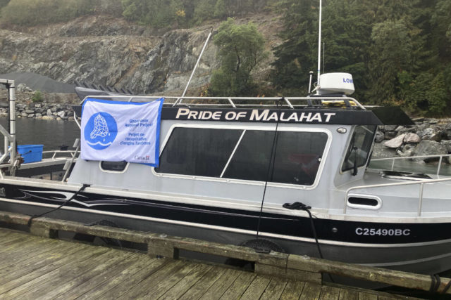
The boat has helped the Malahat Nation find and map discarded waste. The Malahat nation will continue to use both the boat and sonar equipment for retrievals until the funding ends in 2024. The overall goal is to help maintain bay and ocean health in the area to maintain the ecosystem. Read more here
How drones and AI could help stem the spread of a plant invading Quebec parks
The common reed is causing major biodiversity issues as an invasive species within Québécs provincial parks. This invasive species has been taking over the area by removing the local park’s animals source of food and habitat.
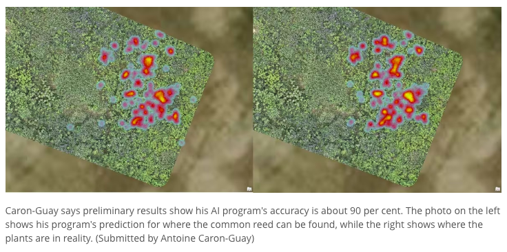
By using drones, field data, and mapping techniques, researches are slowly learning how to identify common reeds in their infancy before they start spreading. With enough data, an AI program helps expedite the process by analyzing photos within minutes. The removal process can take years so getting ahead of the game before groups spread too far can help control this invasive species. You can read more here
GHGSat: Commercial satellite will see CO2 super-emitters
The Canadian company GHGSat will be launching “the world’s first commercial satellite dedicated to monitoring carbon dioxide from orbit will launch later this year”. The satellite will use shortwave infrared sensor at a 25m ground level resolution to detect CO2’s specific light signature in the atmosphere.
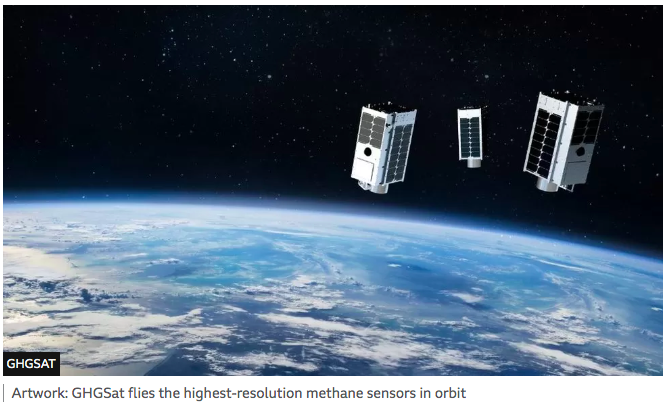
The satellite will be used internationally to sell government bodies data on their emissions so they can work to meet the Paris Climate Accord numbers. By being an independent body, GHGSat helps remove bias. Read more here
Canada Launches Mapping Tool for Marine Planning and Protection
The Minister of Fisheries, Oceans and the Canadian Coast Guard, have launched the new Canada Marine Planning Atlas. The aim of the atlas is to show economic, ecological and sociocultural activities to help improve ocean management by ensuring Canadian marine spaces are used in a coordinated way.
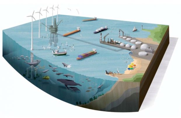
“The Atlas will be featured during IMPAC5, the Fifth International Marine Protected Areas Congress, in Vancouver, Canada, from February 3-9 2023″. Red more here and keep up to date when the atlas will be revealed.
New LiDAR Point Clouds product: Canada as you’ve never seen it before!
Natural Resources Canada has announced that it has release a new product known as LiDAR Point Clouds. The product is meant to support National Elevation Data Strategy by optimizing data in a Point Cloud format. The data is being distributed in a compressed format which allows for more efficient use.
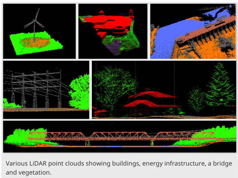
For specific details on the product, please read more here


Be the first to comment