“I want it! I want it! I want it!” – “Magic Bus” – The Who
The Glass Floor. There is glass floor of precision and accuracy that has sometimes been a hindrance to geospatial field data collection. The premium on high precision positioning has traditionally been in the cost of hardware, narrowly purposed software, and in skill (one does not get down to those last few centimeters of global positioning without taking into account geodesy, datum, projections, and determination of statistical uncertainty in measurement). Setting aside the latter considerations for moment, developments in software, mobile hardware (namely that wonder phone in everyone’s pockets) and the comfort level with “pro-sumerization” of geospatial technology has all of the pieces in place – except for the positioning hardware, and that could change real fast. (A footnote appears later for nervous licensed surveyor like me, and a gentle reminder to non-surveyors about the legal implications of high-precision positioning).
Dreams about 3D GIS and Geodesign, effective asset inventory and asset management for utilities, etc.: without higher precision (or validation and registration of remote sensing data with high precision) these hip and trendy aspirations might be limited to legacy “schematic” data and having to rely on a lot of extrapolation and rough modelling.
Rise up – you do not have to settle for the legacy notion of +/- meters; no more “face-painting with a roller”; add spice with a precise device (nice!). Software and apps are there already: field data collection is now quite practical with even simple apps on your phone, tablet, hardened tablet, or purpose designed hand-held data collector – commercial, proprietary, open source. Those mobile mapping apps have many enterprises and utilities worldwide “in-sourcing” their mapping. There is a trend towards “crew sourcing” , which is a lot like “crowd sourcing” except you limit the folks collecting data to those with intimate knowledge of the items they are mapping – like utility field crews. Picture all field staff in a utility being able to whip out that wonder phone (that is probably already in their pocket), viewing the enterprise theme for whatever line-of-business infrastructure they are concerned with, and being able to add missing items, edit items, or updating positions (that might be off by tens of meters in the legacy GIS themes). Not a new idea, and such apps already exist as do some high dollar purpose-designed high precision mapping systems, but what is missing to bring about the “geocratization” of high precision mapping is a peripheral for your wonder phone – and it might be simple and relatively inexpensive to achieve.
Phone-y GPS. There are very practical limits to the GPS in your phone (or GNSS for those using more than one global positioning satellite system). Even if a more complex and capable GNSS chip were placed in the phone, the tiny antennas are horrid at rejecting “multi-path” (signals bouncing off things confusing the heck out of GNSS receivers). An external antenna (at the very least) will make things slightly better, but not anywhere near the centimeter grade positioning that the types of dedicated receivers, surveyors and others have been using for decades – there is more to it. Those dedicated high precision GNSS “rover” or handheld systems have traditionally been rather large and expensive, but for good reason; the various underlying elements were expensive to develop, manufacture, augment, and finesse to achieve those last millimeters. But now those elements have been distilled down into some rapidly changing, readily marketable components – and sticking them into a nice little “puck” peripheral for your wonder phone should be just around the corner.
ABBA. I first heard the term “GNSS Puck” nearly a decade ago from Eric Gakstatter of GPS World. We’ve been exchanging emails since like giddy teens watching the developments towards that goal and speculating about what the eventual impact might be on markets, GIS, and legacy workflows. “Pucks is bucks,” we’d say. Maybe ABBA holds the key. What does everyone’s favorite classic Swedish pop group have to do with it? Think an acronym for “Antenna, Board, Bluetooth, and Add-ons” – A.B.B.A. (Ok, maybe there should be another “B” for battery (maybe Bjork could join ABBA in a comeback tour), but you get the idea – something as simple as the lyrics from said Swedish pop group.
Boards. High end GNSS boards are the heart and soul of all high precision GNSS positioning and have traditionally been the most expensive single component and most difficult to develop and update. Not only do they need to track the US GPS constellation, but now the European Galileo, Chinese Beidou (some have called Compass in the past), Russian Glonass, India’s IRNSS, Japan’s QZSS, and a whole array of regional augmentation systems (SBAS, like WAAS) and commercial real-time PPP augmentation offerings like RTX and Veripos et al – it is not uncommon for a GNSS board to have 440 channels or more. Why so many? More (and especially more modernized) signals like L5/E5 means you can work in more places with limited sky view. The channel number one-upmanship has gotten slightly comical at times. I would not be surprised if there might be an ad campaign someday with Mike Meyers in character with pinky to mouth uttering “one miiiiillliiiion channels. Bwahahahaha”. Sorry… GNSS boards have become the trade commodity of high precision GNSS with Original Equipment Manufacturer (OEM) boards from a growing number of board manufacturers appearing in all kinds of end-products. The common GNSS field “rover” needs a high precision board, a great antenna, and processing engines (RTK and/or PPP, and more).
Boards from Novatel, Trimble, Septentrio, and a host of new Chinese boards are dropping prices. Only a few short years ago the typical high-end board was as much as $5,000 USD, now between $1,000-2,000 USD with some Chinese boards as low as $400 USD – the challenge is maintaining quality while dropping the prices, but drop they do.
ION Bombshell. By ION we mean the “Institute of Navigation” and some news from their recent conference that might drive GNSS Puck development. Shaowei Han, Co-Founder and CEO/President at Wuhan Navigation and LBS, Inc predicts that we may see $100 or even $50 GNSS boards within the next few years. This bombshell was dropped during a panel discussion entitled “High Precision GNSS –What will it look like in 2020” co-chaired by Glen Gibbons of Inside GNSS (and well, me). This standing room only session at the annual Institute of Navigation (ION +GNSS) conference and tutorials featured presentations and open discussion among representatives from the major GNSS manufacturers. The specter of possible future of price wars for high precision GNSS raised concerns of soft markets unable to generate sufficient revenue to support further development, support, and drops in overall quality.
Han reflected on the rapidly dropping OEM board prices that will impact GNSS survey-style rovers, but with even larger markets in other navigation, guidance, and embed systems. One example was the tens of thousands of high-precision GNSS receivers deployed in recent years in the driver’s license test vehicles in China. High precision GNSS is not just for surveying anymore. Han said that even within China, where numbers of GNSS board manufacturers is growing, further cost savings are being sought by manufacturing in western China or “elsewhere”. While Han did not elaborate on where “elsewhere” was, business publications note the potential growth of integrated board manufacturing capabilities in India, south Asian countries, and Africa.
Augmentation. Ok, now with a board, and good antenna (smaller than an actual hockey puck is generally impractical from a board-size anyhow, and not optimal for antenna design), but then to achieve anything better than 10cm there will need to be augmentation. The most common way to wring centimeter precisions out of GNSS is RTK (real-time kinematic… look it up). This comes in the form of “correctors” from terrestrial base stations or networks of stations, and you can get these correctors via the internet right to your phone through “NTRIP client” apps (a public domain protocol for such transactions of this kind, and many of these apps are free). PPP-RTK is a different type of augmentation that can be delivered via the internet or as a service via comms satellites. Your phone that already has communications capability gets the correctors, feeds them to the puck via Bluetooth, then the RTK or PPP engine on the board in the puck does its magic, and passes the corrected, centimeter grade positions back to whatever mapping app you are using on your phone via NMEA standard location format(s).
Flood. If $100 GNSS high precision boards were readily available today there would be a flood of development – small shop, DIY, Kickstarter campaigns – but the cat would truly be out of the bag. There are a lot of free and open source components to the puzzle, even open source RTK software like RTKLIB. Not trying to upset current manufacturers here, but trying to encourage them to get ahead of this thing before we see Bubba-Gump-2020 pucks in the tool bins of your local big-box home improvement store or flat-packed for assembly at Ikea.
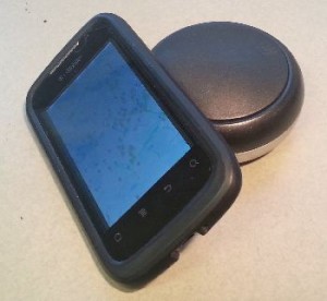
Completing the GNSS Puck. The puck would be very simple: great board, great antenna, battery, USB for charging/data, a little memory for static observations (for post-processing) and Bluetooth. There are a number of current GNSS receivers that are darn close to “puckness”. The pole-top mount Altus NR-2 was hailed by many at this summer’s ESRI UC as one of the coolest things on display, being able to turn nearly any phone into a centimeter grade data collector. The SX Blue series offers a range of options (though shaped more like a small brick than a puck). These and many others are so close. I’ve even taken existing survey-style pole top rovers and done “puck-like” things with them connected to a smart phone. But I have yet to find the stripped down puck as described that could ride the boom when the board prices (inevitably) fall. Even at the current $1,000 or $400 for a board, the potential is great.
Add-ons. The stripped down puck would provide the affordable functionality, but a few add-ons might add a lot more functionality (and assuage the fears of current high-precision GNSS users). A number of folks have commented over the years to my (sometimes hysterical) pontifications about pucks, with some suggested add-ons. Like snap on batteries, ring shaped to snap below the puck down the pole, or a snap on ground plane for those higher multipath environments. Snap on rings with electronic compass, tilt sensors and accelerometers. Maybe even calibrated cameras for fully geo-registered digital photogrammetry (many of the suggestions reflect things that have been added to traditional GNSS rovers over the years).
Legal Implications of High Precision. I’m a licensed land surveyor and would be burned in effigy if I failed to mention the legal implications of high precision positioning and measurement. Just because some technology can tell you where you are to the millimeter does not tell you if it is the right millimeter. The reason why activities like the offering of land surveying services is licensed or chartered has less to do with measurement as it does with the professional evaluation of all evidence needed to determine the legal standing of some spot on the ground – land records, deeds, title, and more. Measure all you want, but once there is a legal implication to that measurement, then there are rules. Get to know them and when to call in the licensed professionals. Licensed folks are not just allowed to add disclaimers to the maps they need to record with the authorities – their license is on the line. Sorry about getting heavy, but it needed to be said.
If all of the pieces were to fall into place, and if there is a viable market for them, then we may very well see GNSS pucks in the next few years.
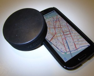
*Note: If you notice the word “Vegum” on the puck in the photo, that is the name of the Slovak company that makes excellent hockey pucks, as that is an actual hockey puck (used to illustrate the likely size of GNSS pucks). But if things work out there might even be GNSS puck manufacturers in say Slovakia, or even my garage (I’d better go out there and finish building the “GSNav 3000”).

GSNav3000? Ha! – but you never know, there may be a wave someday of small shop and DIY GNSS gear…
@schrockg @xyht www.xyht.com


Be the first to comment